


July 12 at camp 17, 04:51 to 05:00, cloudy, but red sun through obvious smoke haze. The second photo faces south to better show smoke at the horizon.

05:02, on my way to the long portage at the upper end of unnamed lake 22. I can definitely smell the smoke and feel it in my breathing.

Looking back at the site of camp 17.


08:02 after the 840 metre portage, heading down unnamed lake 23.

08:29, stopping for breakfast at the top of a steep rockface, the top of the canoe load just visible parked below.


09:09 to 09:15, approaching the lower end of unnamed lake 23, the outflowing creek on the right below the cliff.


The portage should obviously be on the left, and John has placed two orange flagging tapes to mark the spot to make it easy for me.

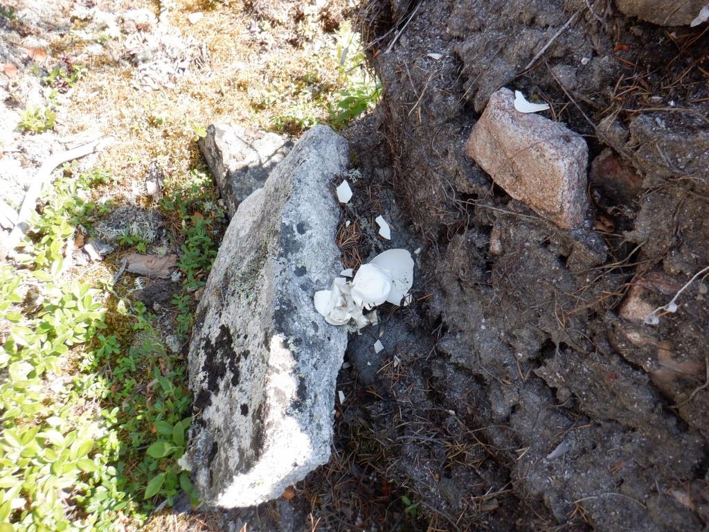
10:32, looking back at the lower end of the 130 metre winter portage.

Heading down unnamed lake 24.


10:48 to 10:51, nearing the upper end of unnamed lake 24, thinking the portage likely to be on the right side, the left being quite steep.

Closing in on the lake's creek exit, now I think with any luck I will be able to paddle/pole down it. I lodge the bow of the canoe in the opening of the old beaver dam, wondering if John went through, as he has a narrower boat. Standing up, I cannot see if the stream is navigable so I back out and land on the right side to check inland for a trail with no luck, walking as far as the rising ground. If there is a path I would have crossed it by this point. The one issue with winter portages that I have faced many times is that snow machines can easily traverse frozen muskeg and water so in a location like this can go straight down the creek area without cutting a trail.


Wanting then to check the left side of the creek, I spot John's flagging tape he left for me, what a nice thing to do! Obviously his portage is on the left side just below the cliff.

Getting as close as I can, I step into shallow water and walk to the end of the path to view down unnamed lake 5. With John pointing the way, I have 'found' the trail in short order. I owe him!
The following photos show the terrain of the 130 metre portage from the lower end at unnamed lake 5 back to the side of the creek running out of unnamed lake 24 where the canoe is landed. It passes through tall grass, thick sweet gale, alder, willow and birch brush, shallow water (shallow if I step in the correct spots) and cattails. I benefit from John's bushwhacking as I can see where he walked out towards the creek in places to look for a better track, and also where he sawed a largish fallen live tree that completely blocked the path.


After carrying the gear to the lower end of the portage, I hoist the canoe but drag it in the wettest or grassy places.


12:36, the view from the canoe back to lower end of the portage and to the creek outlet.

Paddling down unnamed lake 5.

13:04, the larger of two islands that I want to check as a possible campsite, but it proves unsuitable.


13:35, July 12, after exploring the entire area of the smaller island, I settle on the best location for camp, marking where to land the canoe, and where to situate the tent. I use orange flagging tape to indicate the two spots; in the past I have 'lost' good locations that I thought I would remember. In part I suppose I am confirming Jeanette's opinion of some (all?) of my photographs: "Once you've seen one tree, you've seen them all."


July 13, 06:23 to 06:24, a very foggy morning.
The photos below are of camp 18, situated on a small island on unnamed lake 5, one km from the target river valley, after three portages (840, 130, 130 metres) through unnamed lakes 23 and 24, travelling eight km from the previous camp on unnamed lake 22.


A beautiful comfortable camp location. The Tarp shelter is set up bottom end towards the lake to better fend off wind and sun. Initially I erect the top side flush against the bush, pulling it into branches because of a rainstorm, trimming the trees after. The tent is well sheltered but requires felling a large number of trees and levelling the base with extra moss.

The entrance of a trail I cut from camp to the upper end of the island in order to reach two good shore fishing spots.


Unnamed lake 5 provides excellent walleye fishing, eating a pan full each of three days for supper. The pot contains orzo (with nutritional yeast, chicken soup base, Parmesan cheese)


July 13 at 10:28, views from camp across the lake, normal clouds and blue sky.

The same day July 13 at 18:26, heavy smoke is back with a vengeance.

July 14 at 05:01, very foggy, but temperature rises to a hot 29°C, a prelude to tomorrow's 32°C.


The top two photos are of woodland caribou droppings, probably this past spring. The lower photo is of a well used animal bed, possibly the caribou. I wonder if she raised a calf here?


An old Canada goose nest with remnants of hatched eggs.


The tail of a snowshoe hare, white pelage of winter, all that remains of a meal for somebody. There are old droppings on the island, but no fresh (which there would be if there was still a presence because hares love to eat fresh felled birch and alder that I cut to make two trails on the island).

These two 'Mr.' and 'Miss' trees on a shoal near the lower end of camp 18 island, make me smile every time I look (and still make me smile). They are my version of the painting 'American Gothic' (by Grant Wood, 1930) (the one with the farmer holding a pitchfork standing beside his daughter). The trees have unique shapes, the taller 'Mr.' spruce with the large flattish bushy head, the 'daughter' bent over in laughter pointing at him. I am sitting with no clothes, on the rock shore beside the water in some shade, and the antics of the two trees make me chuckle.


Gulls cooling off in the water on a barely submerged rock shoal. Like me they are trying to keep cool on a very hot 32°C day, splashing in the water, wings spread, having a great time. First there is a single gull, then joined by the second, they seem to vie for the prime spot.
**********************
Summary:
An excellent campsite and walleye hotspot. Another heatwave with temperature of 32°C. Distance travelled eight km including three portages (840, 130, 130 metres), the last trail quite wet, through unnamed lakes 23, 24 and 5. Thanks to John for clearing and flagging the portages ahead of me. Evidence of a spring woodland caribou that may have delivered a calf, of a Canada goose nest with eggs, of a winter snowshoe hare kill. Two trees mimic the American Gothic painting.. Entertainment by gulls cooling off in the heatwave.
July 12:
Up at 02:45 before the alarm at camp 17, it seems darker than usual. Hoping the weather is not too ominous, I pack all the gear in the tent before exiting. It is quite cloudy, but smoke-filled air is making it darker, the sun is a red ball, breathing noticeably affected by the smoke. Mosquitoes are a bit bothersome. Not hungry, I leave without eating. After carrying the first load across the 840 metre portage, I breathe a sigh of relief when the two tied barrels are untouched. Across the trail there is one large half fallen tree that is lower this time, so I might have to put the canoe down, but I manage to duck low enough to sneak under. As I return for more loads, I appreciate that John had sawed quite a few trees, and redirected the trail in two places around downfall. From my journal: "I owe him for all his trail work!" Shortly after launching in unnamed lake 23, I stop for breakfast on a steep rockface (peanut butter, LifeStraw® water, mixed seeds, quarter bannock, two protein bars, gum). On each of the three lakes today I see possible campsites on the left side but do not check any of them. On reaching the lower end of the lake, I see John has flagged the portage with orange flagging tape. From my journal: "What a nice thing to do! He has to find the portages, clear if necessary ... and he shows me where they are! Owe him!" This 130 metre winter trail is easy, mostly dry. Moving down unnamed lake 24, the outlet creek has been dammed by beavers in the past. I wedge the canoe bow in the first breached hole but cannot tell from here if the creek below is passable. There is no evidence that John went through the hole with his narrower canoe. Paddling back about 30 metres, I land at the right hand shore, the low side of the creek, the other side a steep cliff. Walking inland at least 50 metres through the grass and brush, there is no evidence of a winter trail, and it would unlikely be any farther on the higher ground. Back in the canoe, I notice John's flagging tape on the extreme left side of the low beaver dam below the cliff. Paddling/poling bow first in the shallow water, I have to wade a short distance before pulling the canoe closer. To check John's path I walk first to the lower end, through cattails, sweet gale brush, grass, shallow water, and a few alders, willow and birch trees, most of the 130 metres wet underfoot. Stepping once in a hole over the top of one boot, after that I pick my footing so my feet stay wet but not sloppy wet. I do spot an old saw cut, so others have gone this way before. John sawed a six inch diameter down spruce tree. I can see where he walked towards the creek a few times when figuring out the best path, so I know his feet would have been wetter than mine. Now with his latest bushwhacking and trail making, I really owe him! The winter trail would just be on top of the frozen landscape closer to the creek, no need to cut a portage. I trip and fall once, hitting the back of my head on the sharp branch of a tree, making me give myself a lecture about being more careful with footing. (Later my bruised head is repeatedly targeted by darn blackflies and remains swollen until I get home.)
Canoeing down unnamed lake 5, I note the right hand side continues to be very high, no chance for campsites. There are possibilities on the opposite side, low open rockfaces at shore. But I am aiming for the larger of two islands close to the lower end of the lake. Approaching the island, I can see that the right hand side is not promising. Landing at the upper point, I investigate two areas, but they are very bouldery with thick brush. Paddling next along the left side of the island, it has steep cliffs. Lastly canoeing to the lowermost point, I stop but there is no good place inland to camp. Close by, the smaller flatter island looks better and I land near the upper end and walk its entire length on both sides of the isle, more difficult in the thick bush on the right hand side, mostly open along shore on the other side. I find two possible tent sites, but one, after felling trees, would be bumpy under, so I flag the better one which is sheltered with thick bush even though this is a narrow 80 metre wide island. I flag it so as not to 'lose' the location, also flagging near shore so it will be easy to see from the canoe. Back to the canoe, I paddle to the marker, a decent spot to land. From my journal: "At a place where someone? or some animal or some UFO perhaps spent the night, all compressed." Later when I see woodland caribou droppings, I think this may have been where a caribou delivered her calf or calves in the spring. It is 13:45, hungry I eat lunch before unloading canoe, but I am tempting fate as although quite smoky it is also very cloudy and thunder gets me moving. After unpacking the canoe, I fell two small trees to allow parking it and store some gear underneath. I clear a space for the Tarp shelter, and because of the strong onshore wind I situate the Tarp ridge directly against the spruce bush, through branches which I will trim later, and tie the bottom very low to the ground towards shore. Gear is already covered by the medium tarp with the big Tarp directly over the pile. I am getting a bit wet already but the shelter is up just in time for a very heavy rain shower that lasts about 15 minutes. Dashing out to fetch the Kitchen Barrel, I unload the pots to be ready when the rain stops. The next challenge is getting the tent site ready, which entails cutting about 50 trees including a short trail from the Tarp shelter. Most are small trees, predominantly spruce but also some pine, alder and birch, largely around the periphery of the tent base to increase the size of the lucky spot I found. It has two boulders poking through the moss; one will be under the front vestibule, but the other in the middle. I do have to fell a few large trees in the centre, but saw deep into the moss so the stumps will be covered. To level the bed area I use the axe head to bring some moss and humus from the periphery, plus a few armloads from farther away. After the nylon tent is up, packs stowed and sleep gear laid out, time to make a fireplace in the earth-exposed bowl of a long overturned tree which also provides rocks to ring the fireplace. Supper is at 19:00 eaten out in the open on a piece of levelish lichen-covered rockface overlooking the lake about two metres straight up from the water. There are three sloping places to get down for water. I intended to have a bath, but now it is quite cloudy with a cool wind so I have a hot water basin wash instead. In bed by 21:30, I am weary and tired. Using two folded tarps to level the head of the bed, noting to add the PFD tomorrow night, I sleep well. By early morning I am cool, even with pajamas on inside fleece shell, curled up in the fetal position to keep warm; finally at 04:00 I crawl into the sleeping bag until 06:00; it is 10°C, a nice welcome change!
July 13:
Sleeping in until 06:00, late breakfast stretches into lunch after doing some chores. A light wind blows smoke away bringing a blue sky laced with white cumulus clouds but I can still see smoke haze at the lee horizon. First priority is fishing and I am pleasantly surprised to catch a big 18 inch walleye from shore about 30 metres from camp, where I optimistically leave the fish bat (an 18 inch stick cut on site). There is lots of moss and I bury the filleted fish in three layers to keep cool for supper. Over a leisurely meal which includes freshly baked bannock, I raise the clothesline, catch up on my journal, measure the distance travelled and mark the map with camp 18's location, finishing by noon. I travelled eight km yesterday including three portages (840, 130, 130 metres), the last trail quite wet, through unnamed lakes 23, 24 and 5. Sitting outside on the nearby flattish rockface, I say out loud "What a gorgeous day!" By midafternoon, temperature has risen to 23°C, the wind has switched directions, now moderate, accompanied by more smoke again. It seems no matter the direction, the wind brings smoke. After brunch, I complete additional chores: fetch firewood, improve the fireplace, clear three trails to fishing spots, remove more trees beside the shelter and tent, hang sleeping bag and fleece shell on clothesline, raise the foot of the Tarp shelter, have a bath. The trails require just a few trees to be cut, making it easier to carry fishing gear to either end and sides of the island. Yesterday in the wind and rain, I stretched the bottom of the shelter to the ground but now with it raised about one metre I get more breeze and better visibility. After my bath, I do not feel the need to leave clothes off, in fact a bit cool in the wind, glad to dress again. I have seen several loons, mergansers, gulls and terns. By suppertime, my boots are almost dry, requiring two pairs of socks to help dry from the inside, now wearing a third pair. The thick walleye fillets, plus cheeks and wings, completely fill the 10 inch Dutch oven ... mmm good! (Cheeks are small pieces of flesh, one below each eye; wings comprise the section in front of the two pectoral fins, at the bottom front of a walleye.) Thank goodness I did not catch a second fish, and I remonstrate myself for even having thought about it after landing the first. Now, at 17:30, there is a moderate smoke haze, worse because it is almost calm. By 19:00 the sun is an orange ball through the smoke, and reflected on the lake surface, pretty but not nice. I have been working periodically throughout the day on a hard sudoku, redrawing it at the back of my journal after screwing up; now I will write in pencil but, before bedtime, give up until tomorrow. Bugs have continued to be good, only some horseflies earlier and now a few mosquitoes. A common nighthawk with his 'booming' dives entertains me as I head to the tent. In bed by 21:00, I don pajamas right away, getting in the sleeping bag after midnight, a nice change.
July 14:
Fishing from shore early this morning, the hook gets snagged so I have to take out the canoe to release it. Fishing from the canoe I try various places near my island, but then catch a 19 inch walleye at my first fishing spot. It is 12°C, calm with dense fog when I arise, no smell of smoke, visibility very poor when I take the canoe out. Two terns dart over me while in the canoe and I wonder if they hear my line hitting the water and come to investigate? The fog clears by 09:40, 21°C, a beautiful mostly clear day but I can see smoke haze at the horizons. After lunch, the wind is now moderate and gusting, temperature rising to 29°C by late afternoon. I sit in some shade at the lower point of the island until getting too much sun so move to the Tarp shelter. It is hot and I am sweating doing nothing; I hope this is not another heat wave. Holding off walleye supper till later, I have another bath before 21:00 bedtime.
July 15:
Smelling smoke when I get up this morning, it is 20°C, very smoky, the sun a ruby red ball, not sure if there are any clouds. I catch a 17 inch walleye on the other side of the island from shore, my new favourite spot after trying the old one unsuccessfully. Two terns and two gulls wheel over me as soon as landing the fish. In order to get breakfast from me they would have to be on the spot when I throw out the guts which sink right away; these birds cannot dive below the surface, they float very well. 32°C by midday, there are no clouds, smoke only visible at horizons but I can still smell it. Not hungry in this heat, I forgo lunch, but drink lots of LifeStraw® water. The heat would be terrible if not for the moderate wind. Now I am thinking that Jeanette's text did mean next week for end of heat wave. Sitting in some shade at the lower point of the island, I finally solve the hard sudoku, and just miss seeing a bald eagle trying for a fish nearby. I wonder what drives all the clouds away and make a note to investigate on my return home. (A heat wave is caused by a so-called heat dome, a mass of hot air trapped under a high pressure layer, like a lid on a pot, and can last for days, even weeks. Because the heat is trapped and compressed by the high pressure dome, it gets progressively hotter and there are no clouds.)