

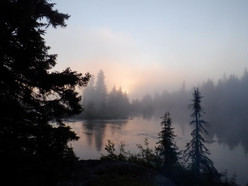

Sunrise through thick fog July 5 (04:15 - 04:37).


Lingering fog at 05:52.


Upper landing at portage past the steep waterfalls.

Breakfast stop a few kilometres below the falls.


Beautiful but poisonous lily-of-the-valley flowers.


Pretty patch of prickly rose flowers.


Striking reflection of cumulus clouds in the calm lake water.


A few minutes later a light breeze ripples the water as I pass three common loons.

Heading up a long bay towards a trail I hope to take to the Churchill River.


No problem identifying the portage landing! The formerly narrow foot path that I used in 1991 with son Steven has been widened to an ATV trail. The portage proves to be heavily criss-crossed with large down trees. Unfortunately the closest island where I would feel safe to set up camp while I clear the long 2½ km trail is several kilometres away. It would be too far to be able to commute with a mostly empty canoe; I could easily become windbound away from camp especially as I am in a long bay that runs far east into Manitoba.

Paddling away from the portage down the bay to search for a campsite.

The eastern view down the lake from camp 11 in the evening of July 5 as the sky darkens with thick cloud. Many kilometres in the distance can be seen the bay into Manitoba.

Looking back to the west at sunset the cloud is more ominous looking and heading my way.


July 6 at 05:51 (east) and 05:52 (west) with rain on and off until noon.


July 6 at 16:39 looking much better, then at 17:32 maybe not so much.


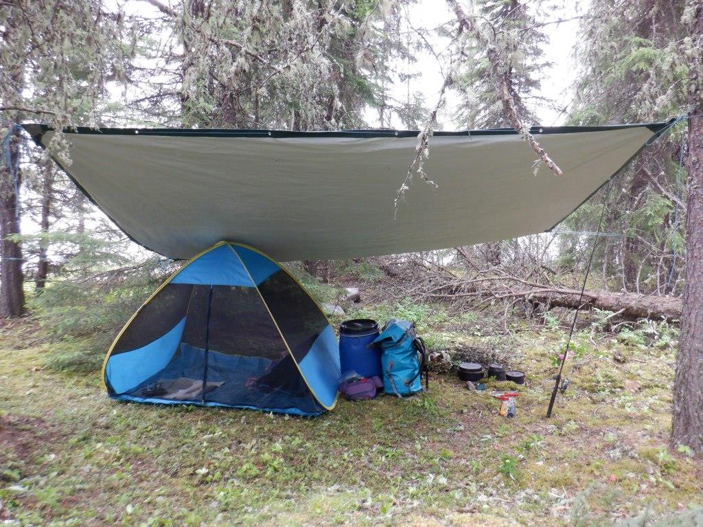
Mosquitoes are bad, hence the Bug Tent.

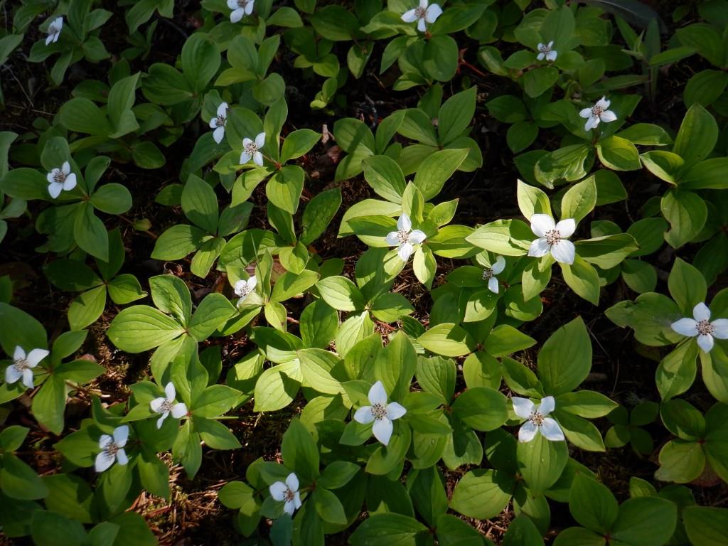
Bunchberries with white bracts each nesting many flowers which will later yield edible orange berries.

A grouse? provided a meal for someone.
**********************
Summary:
Disappointed to discover that a portage to the Churchill River I hope to take is impassable without significant clearing; there is no safe place close enough to leave an unattended camp while working on the long 2½ km trail. Unexpectedly find a campsite at a very old cabin location where I recognize some rusty bed springs recovered from a forest fire; they bring back memories of a 1991 trip when son Steven and I met a Cree elder whose parents owned the cabin. Several islands under water due to high water level. Camp 11 is 10 km from the previous camp but I have travelled two km extra checking campsites and four extra scouting the long portage (a total distance of 16 km, including the 150 metre portage).
July 5:
On arising at 03:30, I pack the gear inside the tent preparing to move on. I reset the alarm to 03:00 which still provides enough daylight; I had changed the time at the last camp when I thought it was too dark but that was just because of cloud. When I exit the tent, there is a heavy fog obscuring visibility to a short distance. When I land across the river there is little space for gear so as I unload I carry the usual two packs-plus at a time to the end of the 150 metre portage. The slope at each end of the trail is a steep 45°. The lower end is a rock slope where gear could slide into the deep lake so I place items that might slip above more stable packs. I was going to use the barrel harness but decide instead to carry the barrels without. They cannot be safely placed on the steep rock shore so leave them on vegetation just above (laying down so they do not roll into the lake). I drag the canoe on the grassy trail until I reach the rock where I place it parallel to the water. If the rock was wet and slippery, loading here would be difficult. When I try to tie the painters to anchor the canoe before putting it in the water along shore, I realize I have to use one longer rope. Luckily there is a spot on the rock in the correct place for footing when loading the canoe. A few kilometres down the lake I stop at some bare rock for breakfast with two pelicans nearby to greet me. When I leave it is sunny and calm, later a light wind, so I make good time. The map shows an island where son Steven and I camped in 1991 but it is solid thick bush now with no evidence of our camp. Beside it is another island which is now mostly under water. Stopping at a nearby bigger isle there is a location that would serve as a campsite with clear areas for tent and Tarp shelter plus a spot near shore where I could dig a fireplace. I doublecheck to make sure the sand is not an ant hill which looks like soil but will burn.
Heading up a long narrow bay towards a portage to the Churchill River I pass another island that is not suitable for camping. Farther on I paddle towards an isle shown on the map but finally decide I have reached mainland which means I have paddled directly across the island now almost completely flooded due to the high water level; I thought it was a shoal (which it is now). I am checking for campsites close enough to the portage where I could camp if required to clear the trail. Paddling up the bay along the north shore I stop at two places that are not even suitable for a lunch break. Tall aspen trees all the way along the shore are dying due to high water. Finding the portage landing is not difficult because there is so much garbage, including fish nets, old fridges and plastic bins plus much other smaller items. Aie! Landing amongst the debris I walk inland on the trail, now an ATV trail much wider than the path Steven and I used in 1991. Interestingly then (later in the year) the bay was filled with tall wild rice that we could not see over even when standing in the canoe. There is a very dead looking four wheeler beside the trail trashed by bears. Going farther amongst the tall aspens I find some shade to eat lunch. I take the canteen for drinking water as to fetch good water for the LifeStraw® I would have to paddle the canoe out to fill the bailer. After lunch I take gear back to the canoe and get the tools. From my journal: "Heading in on the trail about 500 metres there are 13 spots needing major surgery, one with three large down cottonwood trees that I would have to find a way around. The other trees are medium sized that I can saw or large that I would have to limb to step over while carrying loads. There's also the usual smaller branches that I could clear by hand or step over. Going only 500 metres on this 2500 metre trail I realize it could take several days to clear if the path farther is the same. The reason I would like to take this portage is that I could then go down the Churchill River through several lakes and rapids which empty into the large lake I am now on. Otherwise I have to try going up the Churchill which is not likely possible because of the high water, at least not as far up if I take the portage. The problem is there is no safe site here and no islands within reasonable distance to leave an unattended camp for long periods. There are recent bear tracks on the trail as well as wolf and moose. The closest good isle is five km. It would be too far to be able to commute with a mostly empty canoe; I could easily become windbound away from camp especially as I am in a long bay that runs directly far east for many kilometres into Manitoba. I won't miss doing the portage. I will miss spending time on the Churchill River. Aie!" While having lunch I activate the SPOT™ to show the location to my contacts.
Resigning myself to having to retreat, I canoe back down the long bay on the opposite side intending to go the five km to the island I had found to have a suitable campsite. As usual I paddle near shore both to spot good sites but also in order to more likely see wildlife. I see a few bald eagles, mallards, red-necked grebes, loons and many redwing blackbirds, crows and goldeneye ducks. Heading past one area I realize it might be a good site. On landing it appears to be an old "going to be" cabin site never completed with various scattered rusting gear such as stove pipes and bow saws. Later I realize that a set of rusty bed springs are those Steven and I saw in 1991 that were rescued from a cabin burned by forest fire. Other material we saw is long disintegrated. We discovered the history when we met a local Cree elder paddling in a much patched canoe. We pulled up beside each other and chatted for awhile. Hector had been dropped off several days ago by motorboat at the Churchill River side of the long portage we had just completed. Steven and I marvelled at the small amount of gear in the canoe compared to ours. He did have a shotgun and rifle with him and not much else. The bed springs are ones that he had recently stacked against a tree recovered from his parents' cabin razed by a recent forest fire. Later I notice that the topographic map prepared from aerial photographs dated 1955 shows a cabin at this site. Stopping here to set up camp 11 at 14:45 I have made excellent time. It is 10 km from the previous camp but I have travelled two km extra checking campsites and four extra scouting the long portage (a total distance of 16 km, including the 150 metre portage). Mosquitoes at supper are quite bothersome so I eat on bare rock near shore where I catch a bit of breeze. Unsure of how comfortable the bed will be, there is one good spot in the tent and I sleep well.
July 6:
It has been raining since 06:30, 15°C, very cloudy. Mosquitoes are quite bothersome so I have breakfast in the Bug Tent under the Tarp shelter. When I exit the tent there are mosquitoes in both rear and front vestibules so will light a mosquito coil later to clear the tent of any that entered when I opened the door. Rain continues intermittently until late afternoon and mosquitoes remain bad so I also eat lunch in the Bug Tent. Before lunch I try fishing from shore in front of camp, finally along the bay to the side where I catch a 21" pike, a good catch considering I thought to be skunked. As I walk along shore by the bay I notice how waves driven by strong east winds have washed a pile of soil and logs inland five metres. That storm would be scary, definitely windbound conditions. Although disappointed, I know I made the correct decision not to camp even farther away to clear the long portage. By suppertime at 16:45, rain has stopped, temperature rises to 20°C, sunny with lots of blue sky but still grey bottomed cumulus. Mosquitoes are bad under the Tarp shelter but a light breeze helps keep them away while I eat a tasty pike chowder in the shade of a pine tree near shore. I picked fireweed tops and rose petals in camp for a salad. Finally I have a bath; the mosquitoes leave me alone but now I have to deal with horseflies, somehow managing not to get bit through a combination of speed, splashing and slapping. When the sun appeared I hung out bedding but by 17:30 dark clouds move in so I take down the clothesline and head early to bed.