
Gear lined up to be portaged at the start of the 1250 metre trail. I break up the carries into three trips, one to the edge of the muskeg, the second across the wet muskeg after which I don dry socks, and the third the final leg to the target lake. Horseflies are especially bad on the empty return trip but a leafy alder branch waved about my head keeps them from biting.


A well-deserved lunch break on an island close to the end of the portage. I am weary and my clothes are sweat soaked so it sure feels good to sit down, some clothes hung to dry, boots unlaced.

Then the search is on for a campsite close to the next portage on this unnamed lake. Here I am looking at the small island where I ultimately camp. First I canoe to the planned portage site to make sure I can identify it. I check out a closer spot, but ultimately go back to the island even though it is farther away. The island is more open and wind exposed so should have fewer bugs. It is probably safer from bears too. Camp 13 is two km from the previous camp including the 1250 metre portage, plus one extra km searching for a campsite and finding the next portage site.

The weather is warm but strong winds provide comfort. Sweat-soaked clothes, even including my belt, hang to dry near the fire while I have a very refreshing bath.

One day the wind is so strong at the fireplace area that I eat my meal behind the tent for shelter.

On the fifth day at this campsite, I set up the canvas tent and stove because of cool wet weather that forces me to return to camp after cutting trail almost to the target lake.

A supper of fried pike, oriental noodles, fireweed salad and hot water. I always carry three small Ziploc™ bags in my jeans watch pocket to collect salad greens or berries as I find them, to have one or two servings ahead. This fireweed I found along the trail I was cutting.

A beautiful sunset at 9:15 pm.


Half moon at 9:43 pm.


The last vestiges of the sunset at 9:45 pm. The plaintive calls of two loons echo over the lake. It seems there is at least one pair of loons on every small lake. Adding all those up plus the number on large lakes, there must be thousands of loons in Canada.

On the first day of cutting portage, I clear an 80 metre trail from the camp lake to the tiny unnamed lake where one of two creeks empty into the camp lake.


Then I paddle and pole up the narrow winding creek that empties into the tiny lake.


From this point I cut a trail 50 metres across very wet boggy muskeg, placing brush on the worst places to make a corduroy road. The blazed tamarack tree is at the wettest spot. I avoid jumping from hummock to hummock as it is unsafe especially when carrying a load and feet are going to get wet regardless. This trail is at right angles to the main direction that I must go to get to the next target lake but finally I reach drier land, where I cut another 100 metres. By 4 pm it is time to stop for the day. I am sweat- and rain-soaked, my feet are wet from the muskeg, and there are several litres of rainwater in the canoe. A big fire at camp to dry my clothes is a priority, as is a refreshing bath in the lake.
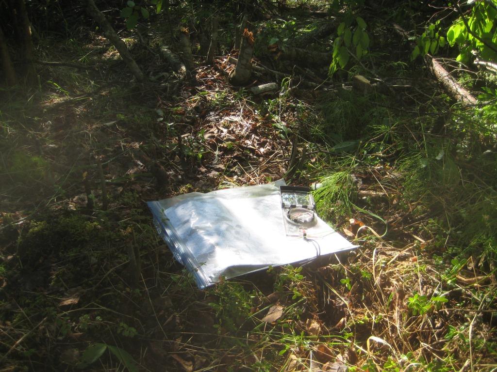

Once I reach drier land, based on the topographic map, I take a bearing with the compass towards the target lake. The compass is corrected for the current year's magnetic declination so it relates closely to my GPS.

I take a GPS reading to identify my grid location on the map. Over the course of the trail making, I take a GPS reading each day to identify how far I have gone and to make sure I am on the correct heading. I rarely use the GPS but when needed it is very helpful.

When taking the compass bearing, I select a distant landmark to which I will cut a trail, and then progressively identify more landmarks as I progress towards the target lake about one km away. In the bush these landmarks are trees such as the forked one in the photo. I target the midpoint of the target lake so as to give myself some room for error. I sure hope that I am cutting a trail that is going to be portageable. From my journal, "In my favour this time, there are two contour lines 10 and 20 metres high to climb but spaced well apart. However, the gotcha is the two contour lines close together at the upper end above the target lake. So I have to go down across these two (20 and 10 metres high) but that's better than having to go up! With any luck there might be a draw to go down, but that's probably just wishful thinking." (The closer the contour lines of different elevation on the topographical map, the steeper the slope. The first exploratory trip I did with the same elevations of contour lines but closer together, the slope was more of a cliff and not readily portageable.)


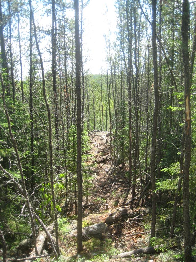
An example of how thick much of the route is. If I did not have the Felco™ pruners it would be impossible to cut the trail. In order to fell trees that are larger than two cm with the saw, I first have to cut out all the small stuff with the pruners. I typically work ahead at least one metre with the pruners before using the saw. On the plus side, at least I do not encounter any recent burns with all their down trees which make for even harder work. There are dry burned trees to throw off the trail, but they are easily moved without cutting.


I keep the trail as straight as I can. Occasionally I do have to zig one way in which case I zag back to keep on track.


On the third day, I cut another 300 metres for a total of 750 metres. I decide I just HAVE to see if the lake is really there, so I make my way through thick bush ahead of the trail to spot the lake. Is the darn thing where it is supposed to be ... or rather is my trail where it is supposed to be? Even though I trust the map and compass and my skill in using them, I am relieved when I see the lake. But I doublecheck the map to make sure I am not accidentally at some other waterbody. It would sure suck to do all this work and end up in the wrong place. I did that once a long time ago when "I" knew better than the compass.


On the fourth day I cut 220 metres for a total trail so far of 1020 metres. Finally I have the target lake in sight. Steady rain sets in and mosquitoes come out in force. I still have to walk back to the canoe, paddle and pole to the 80 metre portage, then paddle 1/2 km to camp. By the time I reach camp I am not just sweat-soaked, but rain-soaked too. I do not usually don a raincoat if I am already wet from sweat. After having my lunch under the tarp shelter, I erect the canvas tent and dry out using the stove. It continues to rain all afternoon. I feel good that I am so close to finishing the trail.

Note in the thick spots where I cut trail, the tree stumps stick up like so many toothpicks to be navigated through when walking.


The trail goes down a steep hill and along a rock cliff. The gods are with me to take me directly to this spot. Thank goodness I do not have to redirect the trail farther than the 20 metres to one side to descend the precipitous cliff.


Finally I reach the lake ... and in the correct spot about midway. Yeah! Over a period of five days I cut a trail 1120 metres long. The last 100 metres is very steep so I am glad that I stopped yesterday when I did. When weary towards the end of a long day is no time to take a chance on continuing to work and get hurt, especially because I have to navigate the cliff. Directly across the lake there appears to be a good campsite.

This is the spot near the start of the trail where I have my lunches each day, dry some of my sweat soaked clothes, escape the blackflies in the smoke of the fire and take a rest. The fire is in a boggy spot 50 metres from the creek so I get wet feet just going to fetch water for lunch. I extinguish the fire by placing wet moss on it. On the last day I cut a three metre spruce pole to use to get the loaded canoe up the creek to the start of the portage. I have been poling the almost empty canoe with a paddle but that will not work with heavy cargo.
From my journal, "People probably think I'm crazy and this year's portage cutting would clinch it. Let's hope the gods don't think I'm crazy." On Sunday July 2 a text from Jeanette makes me smile, "R u sick of portages yet?". She can see from my SPOT™ messages that I am spending considerable time between small bodies of water that would involve portages.