Up early as usual to get going to the portage, poling about 10 metres as far as I can push the canoe in the shallow water and deep mud lake bottom. I then put on my wading gear to pull the canoe to within three metres of shore so that I can carry the gear, one item at a time, 40 metres to dry land. My pants are soaked to the top of my legs from the rain and dew soaked tall grass and weeds. It feels good to change to dry clothes. On my first trip to the lake at the other end I rinse out the wet muddy items to drain while I portage all the gear on the 350 metre trail.
The view back to the entrance of the creek I just portaged beside.
I canoe to the upper end of yet another small lake with hopes that I can continue on across a portage, but when I reach it there is no obvious route to continue.
I set up camp about 1/2 km from the end of the lake on a rock promontory, camp 29, four km from the last site, including the 350 metre portage.
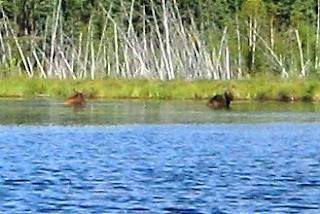
Up early the next morning, to find a way to get to the next lake, there are two moose eating water plants deep in the water near where I hope there is a portage.
I check one side of the bay where there is a creek entering the lake from a different direction than the next lake. A portage is definitely not apparent from shore, so I land at the other side of the bay closer to where I think the route to the next lake might be. This is where the two moose exited to escape. They did not head straight for shore because they knew it was a long run to safety across open muskeg so they swam about 100 metres down the lake to reach a solid spot easier to climb out and be immediately hidden in the bush. It is not an easy walk across hummocky muskeg at the edge of bush that arcs around the end of the lake, with one leg sinking down while the other knee is up at chest level, an ungainly excursion. I go far enough inland to hopefully cross an established winter trail because it is obvious that there is no summer canoe portage on this muskeg. I encounter some old sawed stumps at the edge of the bush so perhaps there was at one time a summer trail on dry land before a forest fire raged through. Now the bush floor is crisscrossed with fallen trees. After about 200 metres I reach a trail and follow it to the upper end. The trail needs very little clearing. I can see where it has existed in various places over the years as it winds through fallen trees. Where the trail ends at a big bay I doublecheck the map and compass to assure that I am at the correct water body. How embarrassing it would be to go to the wrong place. On my way back to the lower end of the trail, I stop to pick two servings of fireweed salad. At the trail end on dry land I break off the tops of several spruce trees to mark the spot. From here to the lakeshore is at least 100 metres across not only boggy muskeg but a small pond. I try to walk around the pond but the muskeg is very wet and I sink down way too deep to be able to get myself across, let alone carrying a heavy pack. This is a winter portage where snow machines can cross the frozen muskeg with ease. I walk back to the canoe the same way I came. For a moment I consider the feasibility of cutting a trail on drier land to reach the 620 metre dry land path but it would add at least 200 extra metres, probably more. I canoe to the point in the bay where I can see the trees I broke off to mark the trail. Aie ... it is a long way. Now I can visualize the path that snow machines take across the muskeg. It is easy to see it after I know it is there. I walk off to the side a bit on drier muskeg hummocks and manage to only get my boots and bottom of jeans wet. When I reach the pond I see that it is about 30 metres across shallow water on mud. Aie! The distance back to the canoe is 100 metres. Not looking forward to this portage.


