
My tent site of camp 31 after taking down tent.


At the start of the 800 metre portage there is a steep vertical two metre rise where I have to carry packs up one at a time to place them on level ground ready to go the full distance.

There are many large trees to step over.


After getting past the area that is blocked by down trees, I think it will be a smooth carry until I get to a large poplar over the trail. When I first walked the trail to identify where it went, I forgot that there were a few spots needing the saw on its lower half. I have to set my packs down several times to cut trees across the path.

On my walk back for another load, I pick some red currants for supper. I try to keep two meals of salad and/or berries gathered ahead and stored in the cooler.


I eat a few handfuls of raspberries along the trail. They do not keep well stored in plastic bags.


There are many large trees across the trail that require high stepping to get over, the reason that I saw off the limbs so I do not get hung up and fall. By the time I finish portaging, my clothes are sweat-soaked.

The river runs over large boulders, some not visible under the surface, so occasionally the canoe gets hung up forcing me to back paddle and wiggle off. I try to go slow through stretches like this so that the canoe does not get so grounded that I have to get into the water and mud to free it.

Some portions of the river are slower to go down because of the thick growth of water plants.


The next rapids has an old beaver dam that has long ago broken open. In places like this it would be easier going if the dam still existed as the backed up water would be deeper and the boulders covered. I think some sections of this river in a low water year would be impossible to canoe. The portage has several trees to remove before I can portage. There are recent bear tracks in the mud at the dam where I have lunch.

Looking back upstream at the base of the beaver dams rapid.

The river meanders through a wide low valley.

The sun at 3:38 pm, shining orange-red through thick forest fire smoke that has been present all day.


The river wanders through tall cattails and yellow water lily pads. There are two very low old beaver dams that stop me. I back up the canoe so that I can reach out and pull enough sticks out to allow me to paddle and pole the canoe through. Thankfully, I do not have to step out of the canoe onto the dams.


The river outlet to this lake is obstructed by tall horsetail and wild rice plants that I paddle through. Looking back I can see the path parted by the canoe.
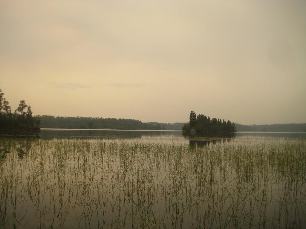
Finally I see the lake itself. It is 4:06 pm and time to find a campsite.

Camp 32 is six km from the previous campsite, including three portages 100, 800 and 140 metres long, and crossing two beaver dams.


Recent black bear scat and overturned logs right beside the tent site.


The smoke is quite heavy and obstructs visibility, made even more uncomfortable in the 29°C temperature.


Another spot where camp is up a steep slope, and there are five tiered levels. There are hundreds of lingonberries that yield easy picking. I have to fell lots of trees and brush to make room for canoe, fireplace, tarp shelter and tent.